Beaches Nearby
Beaches Nearby
1. KOMMOS BEACH ( Eleonas country village –Kommos 27.8 km 43 min )
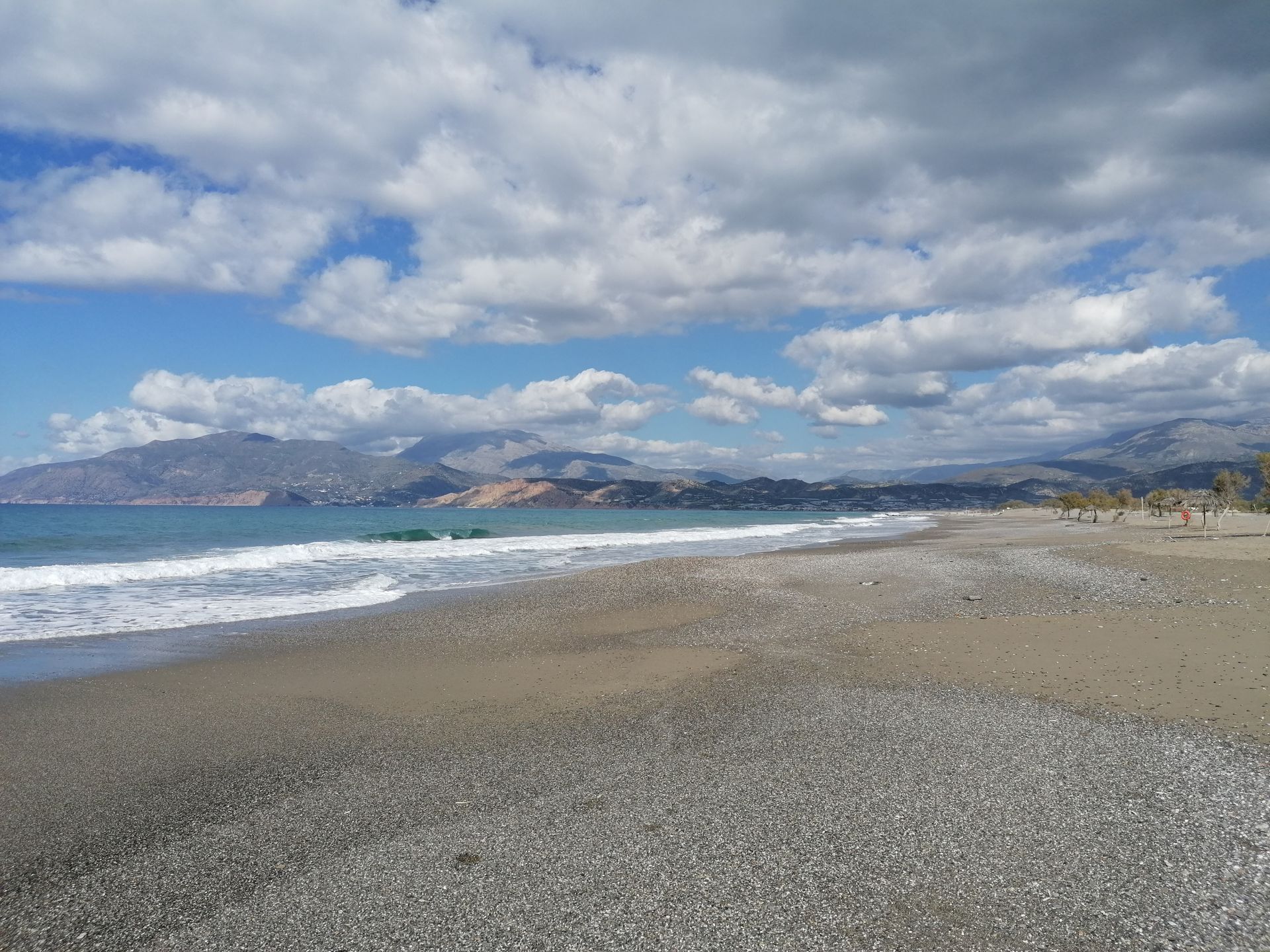
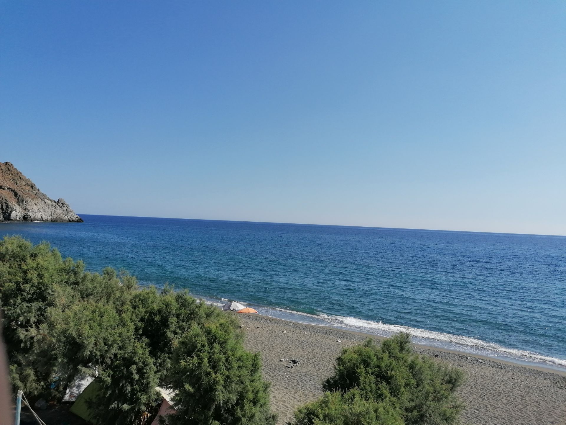
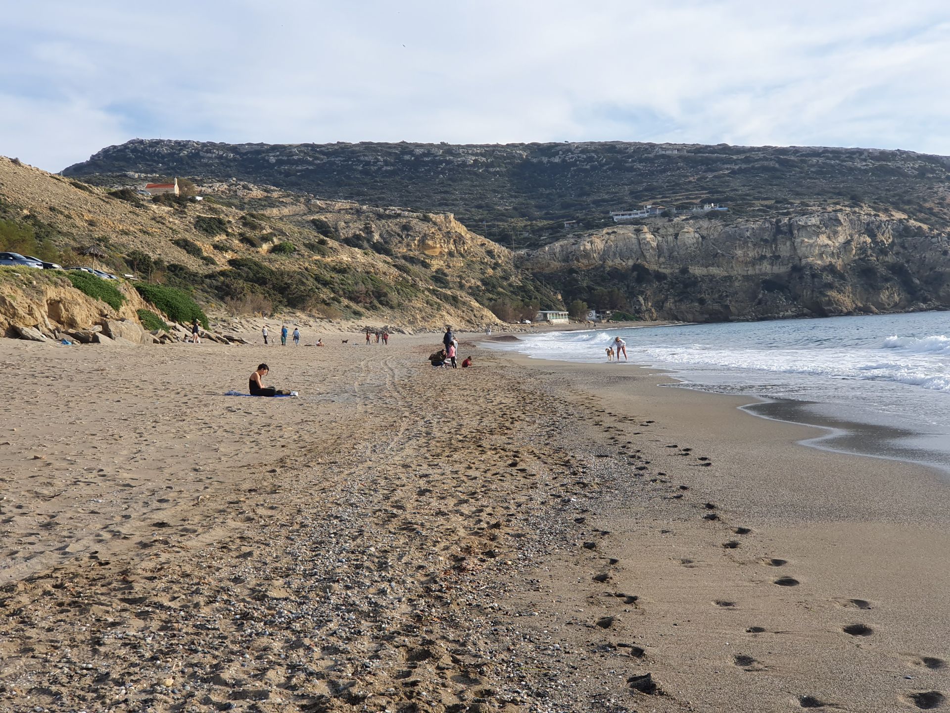
Kommos sandy beach (or Komos) is just 2km north of Matala and close the seaside of Kalamaki village . It is actually the southernmost and the most isolated part of the huge beachfront of Mesara Bay. Kommos was once the port of Phaestus, so you can still see the ruins of the town, near the beach. You can access Kommos by driving in the road heading to Matala, till you see a sign to Kommos. You can park at the church or continue until the beach if is not busy , totally on the left side is the best area for swimming without rocks . Kommos beach is quiet, sandy beach a part of it is organize . The protected sea turtles Caretta caretta nest in the sand of the beach, from May to September.
Next to the archaeological site, on the south, there is an organized beach with umbrellas, sun beds, toilet, showers, a tavern and a lifeguard. All around there are many trees and huge sand dunes where you can admire the white lilies of sand, which sign the end of the summer. If you want to find a place to eat at kommos there are 2 taverns .You also walk to the nearby of Kalamaki , you need 35 minute one way ( kommos – kalamaki by walk to the beach 2.3 km).
- Sea water color: Blue Sand type: Sand Depth: Normal Sea surface:Usually wavy Crowds: Quiet
- Accessibility:Paved road • Facilities: Food / water nearby, Umbrellas / beds, Sports, Showers
2. MATALA beach – Red beach (Eleonas country village -Matala 29,7 Km , 43 min )
Matala is located at the exit of a small valley, which forms a large enclosed bay with nice view to the islands of Paximadia.The bay is a beautiful long sandy beach, 300m long, with fine gravel and crystal clear deep water. Moreover, the seabed is quite rocky in some places and the waves, due to frequent westerly winds, are very large and amazing. Furthermore, there is a huge cave on the north part of the beach, from the top of which some "crazy" people splash in the water. The beach is very well organized with umbrellas, toilets, showers, lifeguard, first aids, beach volley courts, snack bars, water sports, excursion boats, etc. It is famous for the carved caves in the rocks and the hippies of the ‘70s. It is located close to Phaestus, the second largest palace of the Minoan civilization. Matala was the port of Phaestus, and on the Roman Times, it became a port of Gortys. The famous hippies of the '60s and '70s found their paradise in these caves, when they visited and stayed in Matala. Hippies expressed themselves freely, enjoyed love and creation.
- Sea water color: Blue, Green Sand type: Sand, Fine Pebbles Depth: Deep Sea surface: Usually wavy
- Crowds: Crowded place Facilities: Food / water nearby, Umbrellas / beds, Sports, Lifeguard, Showers
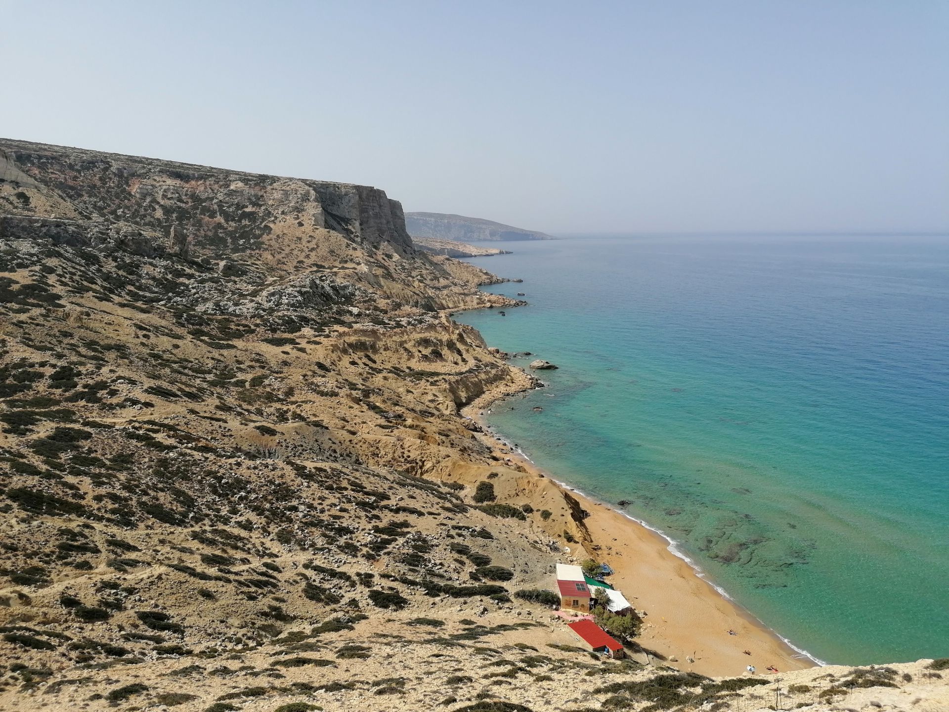
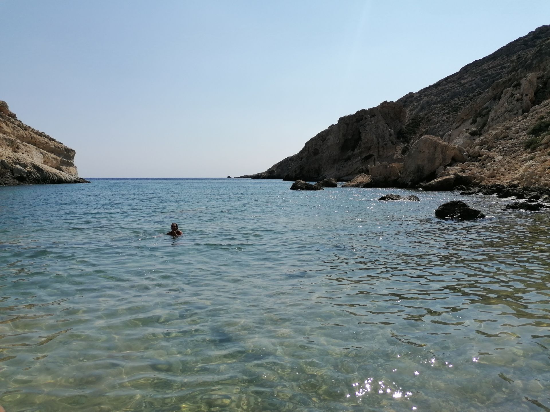
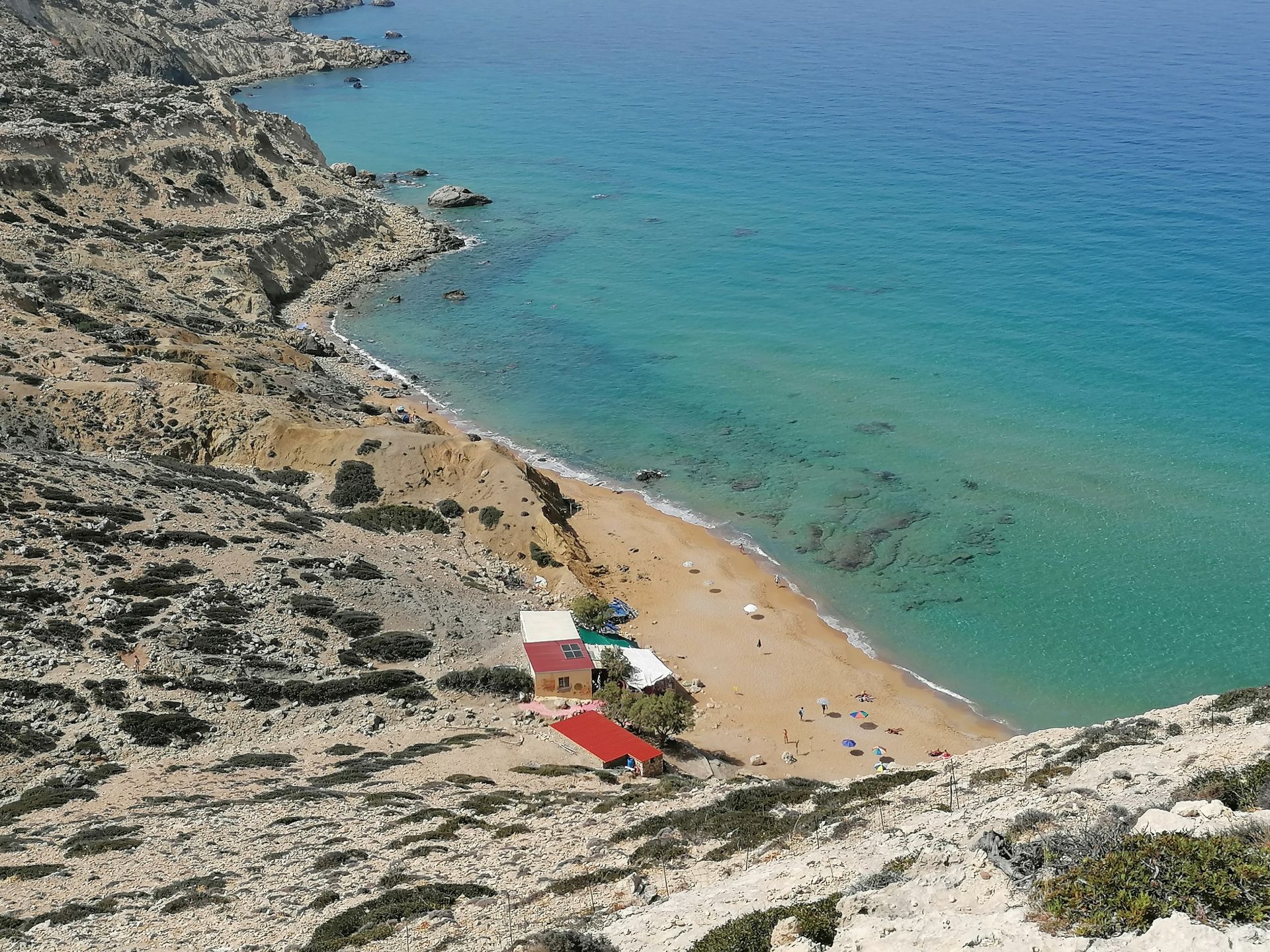
3. Red Beach 20min walking south of Matala
Red Beach is located just 800m south of Matala . To get here you have to walk a trail that begins north of the settlement of Matala and crosses the hill north of Matala. In the beginning of the route you have to climb some rocks and in the final meters you have to descend a steep cliff, but it’s not particularly difficult. After walking 20-25 minutes from Matala and after passing a shepherd’s door (close it back, in order goats not to escape!) you will see the magnificent Red Beach from above. The view from the hill is great and is an ideal place for watching the sunset. The beach still remains nudism- friendly (especially its northern
- Sea water color: Blue, Green Sand type: Sand Depth: Normal Sea surface: Usually wavy
- Crowds: Normal Accessibility: Boat, Walking Facilities: Food / water nearby, Umbrellas / beds Other
- Information: Nudism friendly
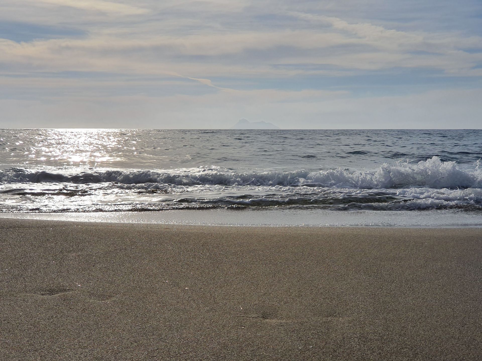
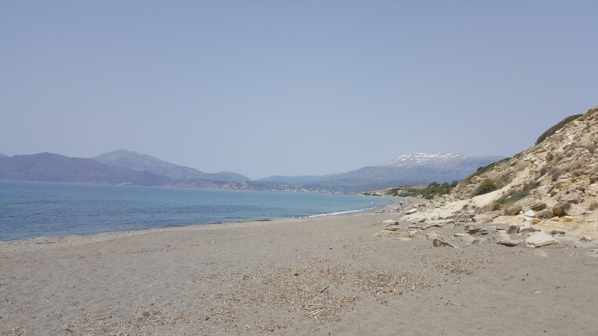
4. Kokkinos Pirgos Beach ( eleonas - Kokkinos Pirgos 28.6 km 39 min)
Kokkinos Pirgos (i.e. Red Tower) is located 28.9 km west of Zaros and close to the town of Tymbaki. The name is taken after the tower that was there and was built with reddish soil. The purpose of this tower at this point is still unknown. It is the seaside village of Timbaki, home of the port of the region and developed touristically. In Kokkinos Pirgos you will find many hotels, rooms, restaurants and cafes.
In front of the village, there is a very long sandy beach, which starts here and extends for several kilometers to the southeast, till Kommos. This huge beach hosts several sea turtles (Caretta caretta), which nest their eggs here in the summer. The turtles and the nests are protected by voluntary organizations. The beach of Kokkinos Pirgos is open to the west winds.
The eastern part of the beach, from the port till the airport, is named Katalyki. Katalyki is a very well organized beach with umbrellas, sunbeds, lifeguard and water sports. There is a seaside road running along the coast with many cafes and restaurants, making this popular for a drink. In the east of Katalyki there is a large marsh, which is one of the most important wetlands in Mesara plain, watered by Geropotamos River.
- Sea water color: Blue Sand type: Fine Pebbles, Rocks in places Depth: Shallow Sea surface: Usually wavy
- Crowds: Normal Facilities: Accommodation options nearby, Food / water nearby, Umbrellas / beds, Sports, Lifeguard, Showers Accessibility: Paved road
5. St. George Beach (Eleonas country village – St. George Beach 43.7km 1h 03 min)
The valley of St. George is located 3km west of Agia Galini, 44 km southeast of Eleonas . There are two small bays with wonderful pebbly beaches, which are separated by a rocky shore. The weather here is always mild, making the beaches ideal for swimming all year round.
Although the area is underdeveloped, on the east beach, which is called Lichnistis, there are a few rooms, taverns and umbrellas. If you come to St. George, you can stroll in the wild Cretan countryside and walk to the Monastery of St. George (500m northern). Note the slope of the church walls, which has been damaged due to ageing and soil sedimentation (don’t worry, it is safe). The Church is known for its old wall paintings.
If you want to stay more secluded, you can go to the west beach called Kolimbistiri (i.e. “swimming area”) at location Louros. Here you can swim alone. Moreover, the seabed is ideal for snorkeling. To access the beaches of St. George, you can follow the asphalt – paved road leading here from Agia Galini (see map).
- Sea water color: Blue Sand type: Pebbles, Fine Pebbles, Rocks in places Depth: Normal
- Sea surface: Usually calm Crowds: Quiet Facilities: Accommodation options nearby, Food / water nearby,
- Umbrellas / beds Other Information: Nudism friendly, Ideal for snorkeling Accessibility: Paved road
6. AGIOS PAVLOS - Sand hills' beach (Eleonas country village –Agios Pavlos 59.6 km 1h 20 min)
Agios Pavlos (southwest) where is a perfect place for snorkeling. The bay has a beautiful beach with green deep waters and magnificent rocky seabed. Near the beach you can find a few rooms and taverns. Moreover, basic services are provided on the beach, such as umbrellas, sunbeds and pedal boats.
Although the beach in front of the village is pretty, visitors mainly prefer St. Paul for accommodation and food, but swim in the nearby idyllic beach with the huge sand dunes. Akoumiani Gialia or Ammolofi , as this beach is called, is behind the western edge of St. Paul bay and is probably the best beach in Rethymno. You can get there through a path that starts from St. Paul.
Agios Pavlos Sandhills' beach ( 06 Km from Agios Pavlos ) is a fantastic bay in a wild and majestic scenic landscape with huge sand hills. There are few umbrellas but you can find shade in the rocky caves shaped in the middle of the beach.
The warm waters are very inviting for a swim and it is quite common to see people in various states of beachwear or lack thereof owing to the area's relative seclusion and privacy offered by the coves around the beaches.
- Sea water color: Blue Sand type: Sand, Rocks in places Depth: Normal Sea surface: Usually calm
- Crowds: Normal Facilities: Food / water nearby, Umbrellas / beds, Showers Accessibility: Paved road
7. Odigitria Monastery - AGIOFARAGO (Eleonas country village –Moni Odigitria 29.5 km 44min)
Moni Odigitria - to start of Gorge Agiofarago 5.8 km 10 min
Odigitria Monastery From Zaros to Μoires and then towards Sivas village – Listaros . Odigitria Monastery is a male monastery located in a protected position of Asterousia Mountains, at an altitude of 250m. The monastery can be accessed through the village of Sivas in Messara Plain. It is one the most historic monasteries in Crete, known for its huge estate, with several chapels and vast land property in Asterousia Mountains. n this sacred place, therefore, the hermits built in the 14th century the monastery of Odigitria. Near the main gate, you will see the legendary Tower of Xopateras with the great story (read it here). Moreover, you will see the baking house, the olive mill, the wine press, several warehouses, the cheese cellar, a small well used during the sieges of the monastery, Moreover, four icons of the famous Cretan artist Angelo (15th century) have survived till today.
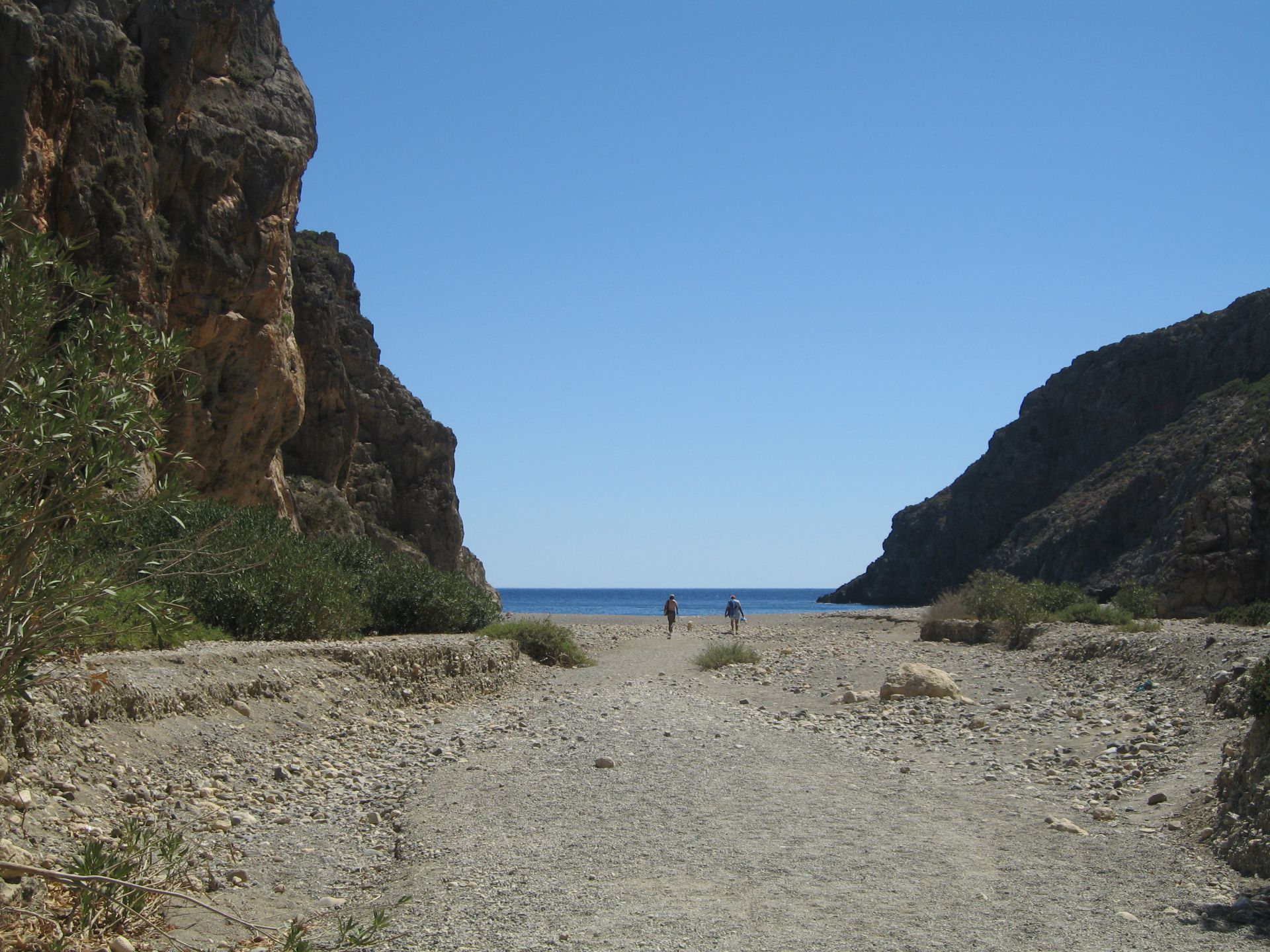
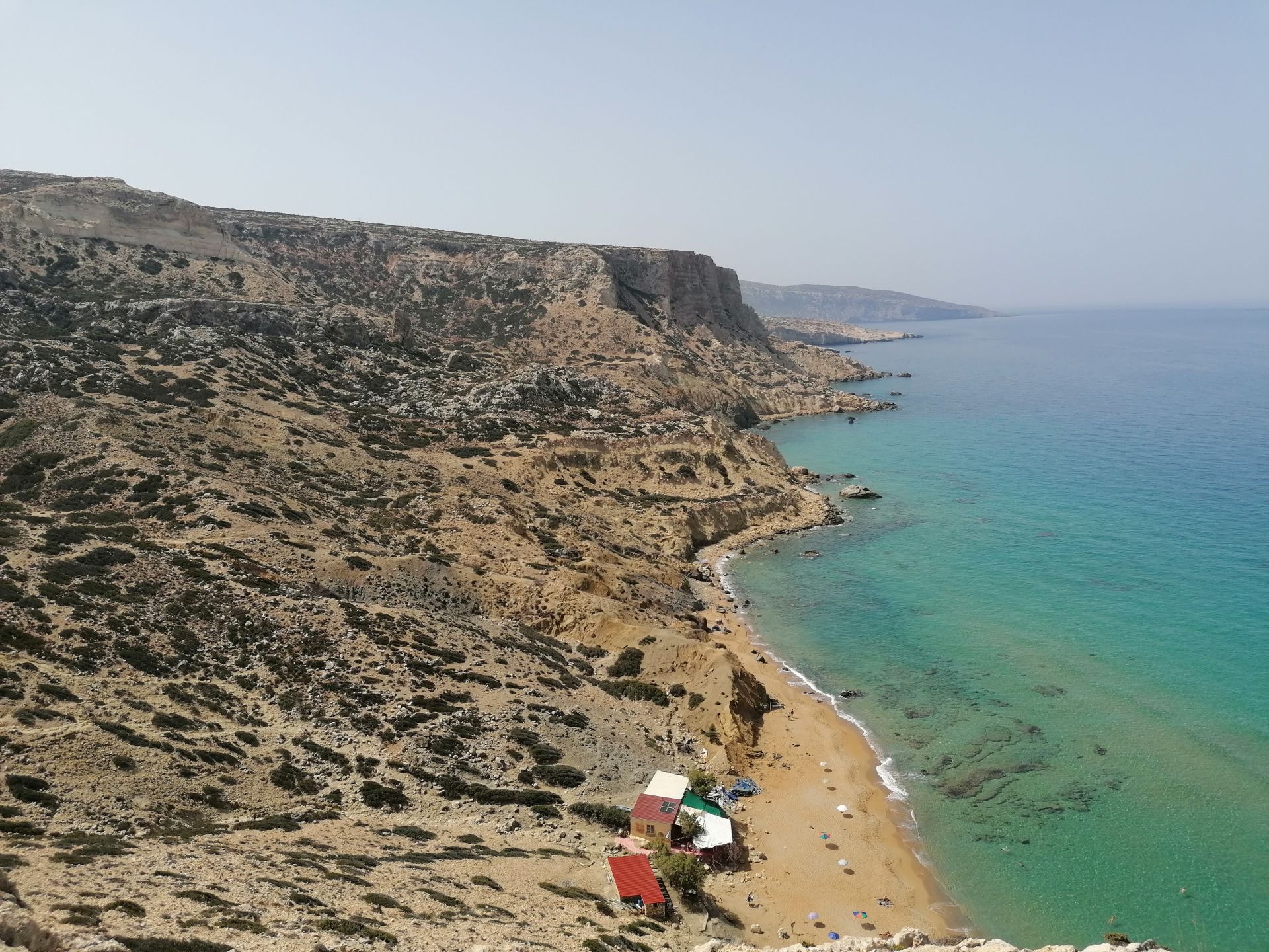
The Gorge Agiofarago . The gorge is bounded by rising huge vertical rocks at its right and left sides, where there are many caves. Agiofarago is very scenic and picturesque, accessed only on foot. The place is isolated, wild and rugged. All this with the fact that it is too far from populated areas made Agiofarago the first center of ascetic life not only of the region but of the whole Crete, in the earliest Christian times.
From monastery Odigitria you should take the road heading straight (the right heads to Vathi) and drive in the dirt track heading to Kali Limenes. After 3.4 km you have to turn right you can also park here ( A ) and start to walk until the beach for about 1 hour& 10 min or you can continue by car for 2.4 km (there might still be a primitive road sign to Agiofarago) till you reach no end, in a wide area for parking ( B ) . Do not leave your car under the tree shade if you don't want to see it ruined by goats, that get on the car roof to eat from the tree. Then walk through the gorge for half an hour until you reach the sea. On the way to the beach,you'll meet the small church of Saint Anthony and the caves. The beach of Agio farrago at the exit of the gorge is stunning, with fine pebbles and clear blue waters, which are usually very calm. West of the beach a beautiful arch is formed, beneath which you can swim. Vertical cliffs surround the beach, on where you might see hermits praying. (You need to have water and something to eat with you as there is no tavern on the beach).
- Sea water color: Deep blue Sand type: Fine Pebbles Depth: Deep Accessibility: Dirt track, Walking
- Sea surface: Usually calm Crowds: Normal Other Information: Ideal for snorkeling/spearfishing, Rock shade
8. Preveli Beach , ( Eleonas country village - Preveli beach 81 KM 1h &40 min).
Preveli is located about 81km southwest of Zaros . Beach of Preveli, also known as Lake Preveli or Phoenix, is located at the exit of the imposing Kourtaliotikos Gorge, where the Great River (Megas Potamos) is flowing. The river, forming a large lake, 1.5km long, before emptying into the sea, has water all year round. You can walk along the river, under the shade of palm trees and other trees, and start ascending in the beautiful canyon. You can swim in the cold ponds formed in the gorge. At the exit of the river, a sandy beach with pebbles and sand is formed, with sea water being very cool due to the river. In the eastern part of the beach, there is a beautiful rock reminding of a mast. Follow the signs to the monastery “Moni Preveli” till you reach a big parking place. Then follow the steps to go to the sea. To reach the beach walk the footpath that takes about 15-20 minutes. However, return is tedious as the ascent is rather steep.
The monastery . Preveli gets its name after the nearby historic monastery of Preveli. It is a men-only monastery, founded in the 16th or 17th century and is dedicated to St. John the Theologian. There are two monasteries, the old and the new, called Piso and Kato Monastery respectively. The old is abandoned and you will meet that a few meters south of the old stone bridge, on the road to Preveli.
The Gorge of Kourtaliotis is one of the most spectacular natural attractions of Rethymnon. It starts from the village Koxare and flows between the mountains Kouroupis (984 m) and Xiro Oros (Dry Mountain - 904m). The huge cliffs of the canyon reach a height of 600 meters and are full of openings and caves, where significant fauna species live. If you wish to go to the beach, you can walk the Kourtaliotiko Gorge (when you see the venetian bridge turn left and keep going for about 400 meters to find on your right hand the path that goes to the sea.
- Sea water color: Blue Sand type: Sand Depth: Normal Sea surface: Usually calm Crowds: Crowded place
- Other Information: Palmtrees, Ideal for snorkeling/spearfishing, Tree Shade Accessibility: Dirt track, Walking